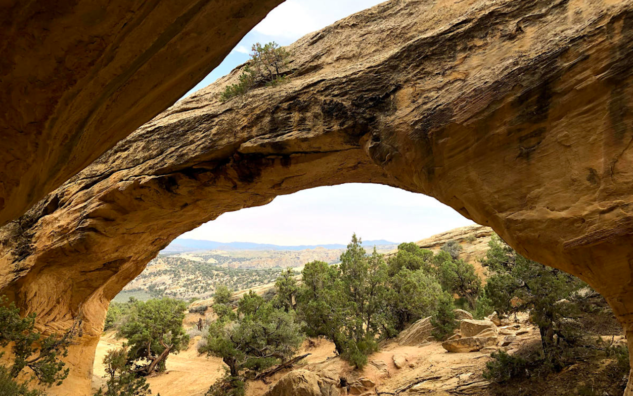
Moonshine Arch OHV Trail
Looking for OHV trails in Utah? Check out Utah.com’s guide to Vernal’s Moonshine Arch Trail and you’ll be exploring and off-roading in no time.
Moonshine Arch OHV Trail | Photo Gallery
Watch this video before you go for an idea of what you'll experience.
The Moonshine Arch Trail is part of the Outlaw Trail system in Vernal, Utah. It allows riders to either drive or hike to the majestic Moonshine Arch, an impressive hidden gem tucked away in the Vernal backcountry near Steinaker State Park.
Trail Overview
If you search “Moonshine Arch Trail” online, you’ll most likely find results for a quick out-and-back hike to the Moonshine Arch. But it’s not only a hiking trail — it can be accessed by both hikers and off-roaders, and is just a small part of the larger Moonshine OHV trail, which begins at the Doc’s Beach OHV area.
From the Doc’s Beach trailhead, riders can either travel along the mellower, lower portion of the Red Mountain Loop toward Steinaker State Park toward Moonshine Arch, or quickly break off from the upper Red Mountain trail out of Doc’s Beach to enjoy an additional loop of the Moonshine Arch Trail. This loop features more varied terrain, and meets up with the lower Red Mountain trail further on. You can also access this loop on the way back.
You’ll be on pavement for a short stretch through Steinaker State Park and onto U.S. 191 before turning off towards the Moonshine Arch Trail a mile down the road. Keep your eyes peeled for the dirt road on the left — there’s no specific markers for it.
As you travel the dirt road, you’ll see two parking lots, one for low-clearance vehicles and one for high-clearance vehicles. If you feel like hiking to the arch, park at the high-clearance lot and enjoy the 1.4-mile moderate out-and-back hike up to the arch (0.7 miles each way). If you want to take your OHV to the arch, be sure to go slowly on the trail and be aware of hikers and other recreationists. Expect wide, sandy trails and some moderate slickrock ascents/descents along the way.
The trail offers expansive views of the valley below, while the arch provides a scenic and shady area to enjoy a break and maybe some lunch. This sandstone arch is 40 feet tall and 85 feet in length, so it’s definitely worth the trip either by foot or tire. When you’re done at the arch, turn around back the way you came. The extra loop of the trail will be on your right, just past Steinaker Draw Road, if you didn’t do it on the way there.
Interactive Trail Map
Click on the icon for each of the obstacles.
Timestamps from video
Moonshine Arch Parking Area: Here you can stop and use the restroom, or park your vehicle and walk to the arch.
Moonshine Arch Trailhead: This trail traverses through sandy and rocky terrain and is rated a 6 on the difficulty scale. You'll stop and see petroglyphs on your way to the massive Moonshine Arch.
Petroglyph Panel: This panel features impressive designs etched across a large cliff face. Look, but don't touch.
Moonshine Arch: A short distance from the arch, you'll find OHV parking. This video has more information on the arch.
Trail Details
Accessible By:
- Dirt bikes
- ATVs
- UTVs
- Jeeps and 4x4s
Total Miles: 20 miles
Trail Difficulty: Difficult and extreme
Technical Rating:
Time to Ride: 5 hours
Seasons to Ride: All year
How to Get There
The trailhead is located at Doc’s Beach, a popular off-roading area in Vernal off of 2500 W St heading north from downtown. From Doc’s Beach, riders will cross the road and head east to the main part of the trail. Doc’s Beach is also a great place to tack on distance before or after your ride!
Need to Know
Because service may be spotty, be sure to bring along a map of the trail system. Screenshot any directions, maps and information you might need (like this article!). Bring plenty of water and make sure your vehicle is fully fueled for the journey. Again, be sure to be on the lookout for the turn off to Moonshine Arch from U.S. 191. It’s 1 mile from your turn out of Steinaker State Park, on the left.
You should also be sure not to turn around before you reach the arch. It’s not visible until the final turn, so it may be tempting to think you’re further away than you actually are.
Downloadable Maps:
Nearby Places to Stay
Doc’s Beach is only a 7-minute drive from downtown Vernal.
Nearby Events
The annual Outlaw ATV Jamboree! Riders from all over the Southwest gather in early June each year to get a taste of Utah off-roading for the weekend. In addition to daily rides, there are cookouts, raffles, a night ride and lots of good times. It’s one of the best ways to explore Utah’s OHV trails and the Outlaw Trail System. So come on down, take in some of the best off-roading in Utah and make some new friends while you’re at it.
TRAVEL BUREAU INFORMATION
VISIT DINOSAURLAND
152 E. 100 N.
Vernal, UT 84078
800-477-5558
Click here for more OHV trails in this area.
FREE OHV COURSE
Utah requires all OHV operators to complete the free Utah Off-Highway Vehicle Education Course. Operators under the age of 18 shall possess a youth OHV education certificate in order to operate an OHV on public land, road or trail. Operators 18 years of age or older may operate an OHV if they possess an approved adult OHV education certificate. The once-in-a-lifetime course is expected to take less than 30 minutes to complete.
Take FREE OHV Education Course
Nearby Attractions
- Red Fleet State Park5
- Dinosaur National Monument10
- Steinaker Reservoir5
