The Wave in Coyote Buttes
Mother nature is usually pretty cagey about her creative process. She wants us to believe all the earth’s features are just coincidental products of natural processes.
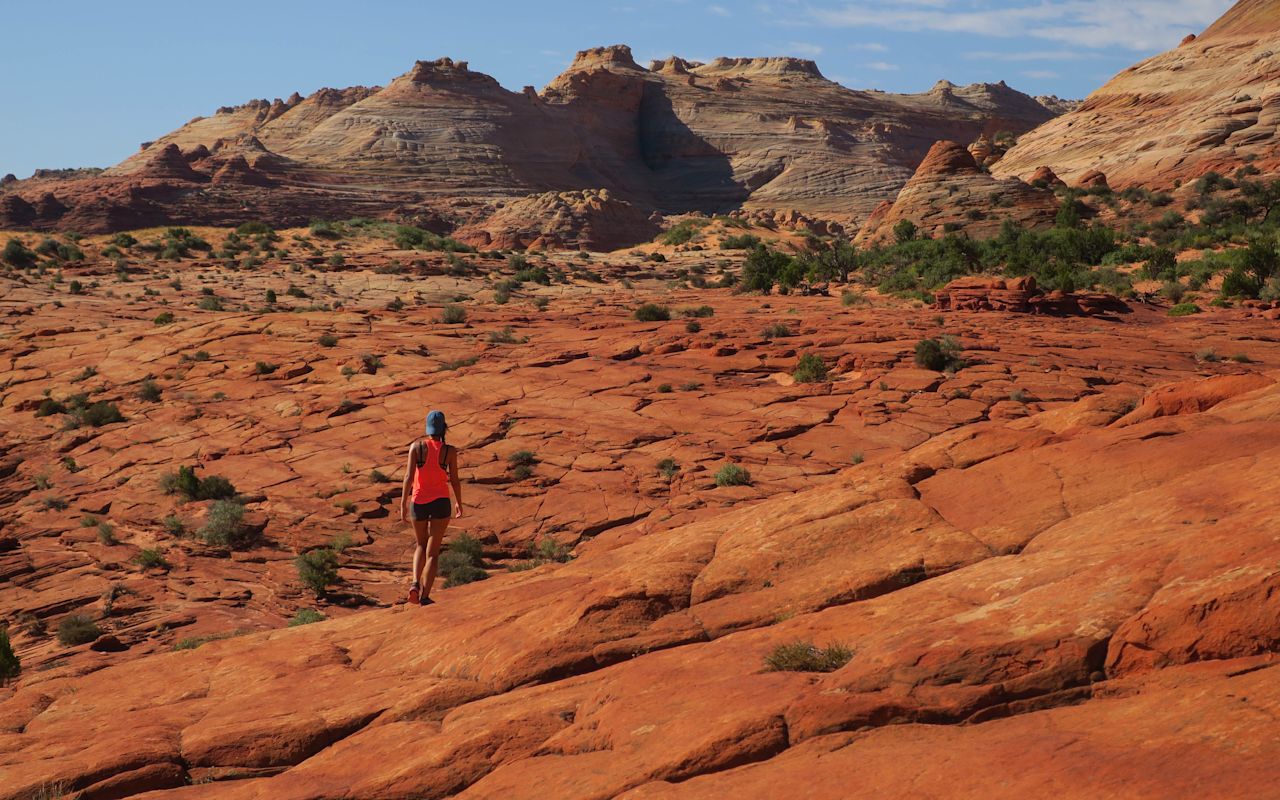
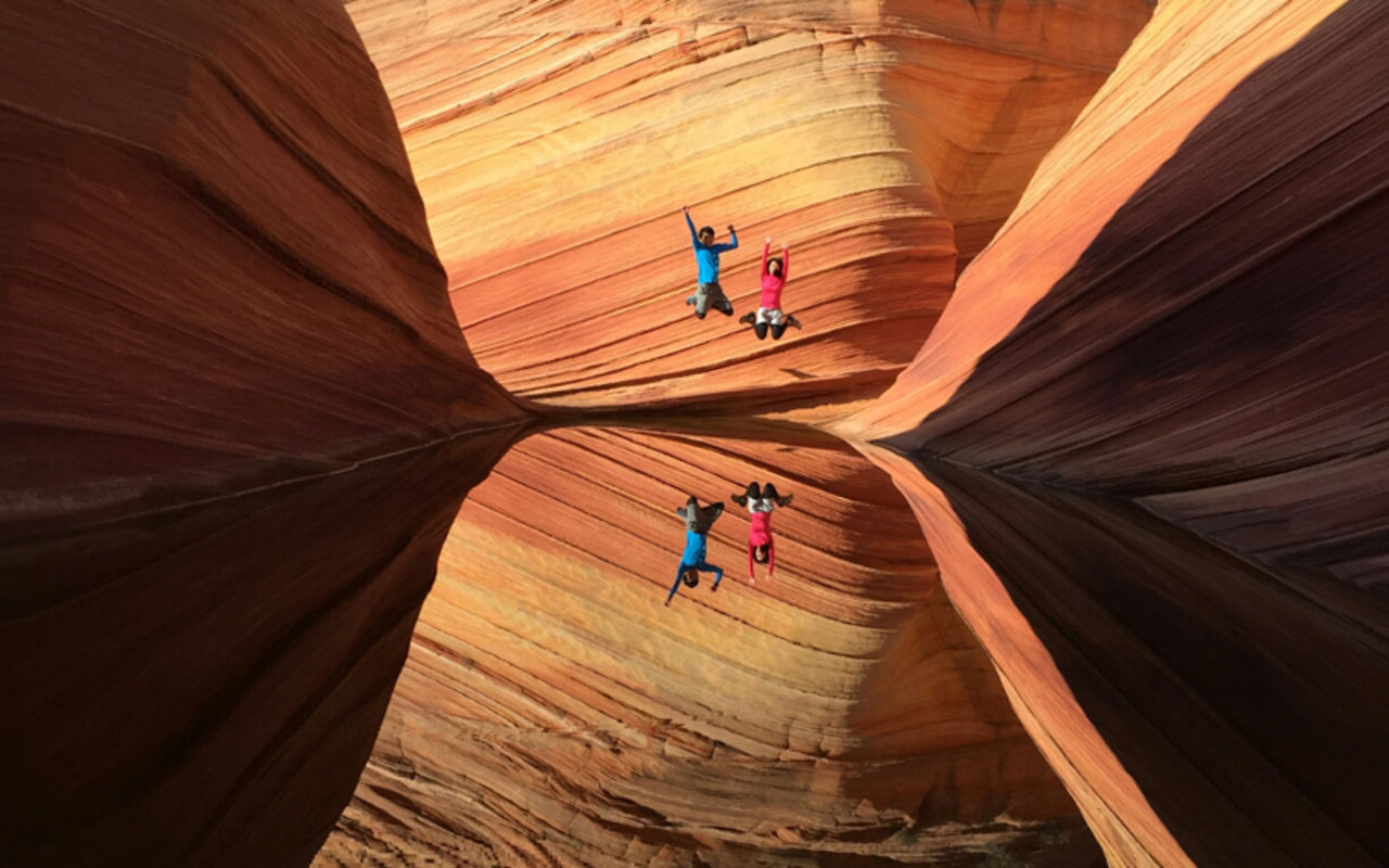
But she tipped her hand when she made The Wave, just across the Arizona border. It’s a little too down-the-middle, beauty-wise, with its baroque bands of red, pink, yellow and white Navajo sandstone arcing precipitously up, down and around ancient stone chutes. A little over-designed if she’s trying to maintain an air of indifference.
Read more…
Promotional Links
The Wave is the common point on the map where world’s geologists, psychedelics, couples taking engagement photos and Victor Vasarely groupies get together and try to keep their mouths closed. It’s like a hurricane, freeze-framed. If you forget your camera, no one will believe you.
HOW TO RIDE THE WAVE: LOCATION & ACCESS
The Wave is in the north section of Coyote Buttes, between Paria Canyon and Vermillion Cliffs National Monument. Turn off US-89 about halfway between Kanab, Utah, and Page, Arizona — if you can get a hiking permit, that is.
The Wave’s overwhelming popularity caused the BLM to limit foot traffic to 64 people per day, so while the hike itself is a fairly straightforward 2.6 miles each way, getting the required permit can be tricky. The majority of permits are issued by lottery for dates four months out; the other 16 are granted one day in advance. The most popular months are April, May, September and October.
Consider yourself warned: Riding the Wave requires either dumb luck or patience and planning. More info on permits here.
GEOLOGY
On its résumé, the Wave refers to its stripes as lithified eolian laminae, but that just means rock layers made of windblown sand. As Jurassic wind patterns changed, different sand dunes blew across the southwest desert, cementing into the striations that now look like a topographic map writ large. The water drainage that carved the two main chutes dried up a long time ago, so now wind is the Wave’s primary erosional force. Maybe you care about all that, maybe you don’t, but keep in mind how many millions of years it took to make before you climb on something you shouldn’t.
Oh, and the Wave doesn’t have a monopoly on Coyote Buttes North’s picturesque. Leave some time to explore nearby dinosaur tracks, Melody Arch, Top Rock, Fatali’s Boneyard, Sand Cove and the Second Wave.
Access world-class longform canyoneering in Paria Canyon’s Buckskin Gulch. Same trailhead as the Wave but a different (self-paid and unlimited) permit.
And if you don’t draw one of the coveted North permits, Coyote Buttes South is bigger and less crowded, with plenty of its own amorphous Jurassic earthwork. Some people even prefer the Wave-less (placid?) South section. See Paw Hole, Cottonwood Cove, teepees, fins, etc.
Coyote Buttes North and South are areas to wander, not trails to hike, so bring a GPS and either hire a guide or do some homework. South permits are easier to come by, but apply early anyway. Four-wheel drive recommended.
PHOTOGRAPHY
Professional photographers, don’t even bother. At the Wave, even an idiot with a flip phone will take pictures that belong on a gallery wall. (Just kidding, pros. We can tell the difference. Do your thing.)
If you’re hiking Coyote Buttes North, you literally won the lottery, so you’re gonna feel pretty giddy to rush straight to the Wave. But take a breath; first consider the theropod footprints in the soft morning light. Save the Wave for midday, when it’s all lit up, then hurry up and try to shoot everything else before you run out of light or energy.
REQUEST INFORMATION
TRAVEL BUREAU INFORMATION
KANE COUNTY OFFICE OF TOURISM
78 South 100 East
Kanab, UT 84741
435-644-5033
Kanab Weather
Average Temperature
Average Precipitation
Average Snowfall
Articles
View AllHappy Trails in Piute County
What do Delano Peak, the Paiute ATV trail and Butch Cassidy all have in common? Utah’s Piute County,...
8 Secrets to Sustainable Travel in Park City
Want a big adventure to Park City without a big environmental footprint? Utah.com can help you explo...
Utah County Is Festive As Heck
Fireworks, parades and corn on the cob — oh my! Utah.com has the scoop on the best festivals and fai...
Natural Bridges National Monument: A Hidden Gem, Not a Second Fiddle
An under the radar destination that should be on your radar. Learn all about Natural Bridges, Utah a...
Plan a Guys Getaway in Vernal
Planning a guys trip? Why not hit the ATV trails in Vernal, Utah with your crew? With all kinds of w...
Treat Yourself to a (San Rafael) Swell Winter
The San Rafael Swell is one of Utah’s hidden gems, and it gets even more hidden in the winter. Utah....
Plan a Triathlon of Fun in Greater Zion
Looking for things to do in St. George this fall? In addition to the IRONMAN 70.3 World Championship...
Color Me (Insert Emotion Here): Where to See Cedar City’s Feel-Good Fall Foliage
Richly hued views await you in southern Utah this autumn. Peep the changing leaves on a scenic drive...
Play Outside and See a Play Outside in Cedar City
Take a visit to Cedar City, Utah, and see why its access to both world class theater and stunning ou...
Mapping Out Utah’s Tastiest Cuisine
Getting to know the Beehive State means experiencing its sites and unique flavors. Discover both whe...
Get Your Peach Thrills in Box Elder County
Utah’s Box Elder county is a peachy paradise — part mountain range, part desert, part orchard and al...
9 Highest Peaks Across Utah
Take a peek at the tallest peaks in Utah. From Kings Peak to the Deep Creeks, Utah.com gets to the t...
Paving the Way for Everyone: All-Access Trails in Utah
From a wheelchair accessible waterfall trail to a lakeside boardwalk laden with wildflowers, these U...
Local Legends in Utah
Ever been curious about urban legends in Utah? Utah.com fills you in all things folklore with our gu...

