Henry Mountains Utah
The Henry Mountains and the surrounding deserts are located in south-central Utah, just north of Lake Powell. Here, almost 2 million acres of public land are administered by the Bureau of Land Management. There is a wide variety of outstanding recreational opportunities including, hunting, hiking, camping, sightseeing, photography, and nature study available for those who are willing to seek them out.
Caution
The Henry Mountains area is extremely remote; BLM personnel do not make regular patrols of the area and the chances of meeting other people in the area is low.
The region is very rugged and dry. Carry extra water regardless of your planned length of stay. Be sure your vehicle is in good working condition.
Over 30 percent of the precipitation in the Henry Mountains falls in July and August, usually in the form of heavy thunderstorms which may temporarily wash out roads. Roads other than Utah highways are either gravel or dirt and not all are regularly maintained, making them unsuitable for some automobiles. Roads at high elevations can be impassible due to rockslides and snow. Bull Creek Pass is usually blocked by snowdrifts until late July. The BLM Office at Hanksville can provide current information on road conditions.
Flora And Fauna
The Henry Mountains are the home of the only free-roaming and huntable herd of American bison in the 48 contiguous United States. In 1941, 18 head were transplanted from Yellowstone National Park to the Henry Mountain area. Today over 200 buffalo roam the lower benches of the Henry Mountains in the winter and the higher areas during the summer. Approximately 44 permits to hunt the bison are issued annually by the Utah Division of Wildlife Resources.
Please remember that bison are wild animals. Do not leave your vehicles and chase the herd, as they can become quite dangerous if provoked. If you wish to photograph bison, drive slowly by and take the pictures from your vehicle.
The area also provides habitat for mule deer and a small population of antelope. Mountain lions dwell in the Henry Mountains and are seen by travelers on rare occasions. Deer and a variety of birds are best viewed from McMillan Springs, Lonesome Beaver Campground and The Horn.
Game birds found in the area include pheasant, snipe, chukar, quail, dove, band-tailed pigeons, blue grouse, and occasional waterfowl during the fall and spring. Small birds include Clark's nutcracker, ravens, kestrels, chickadees, stellar jays, pinyon jays, towhees, and desert horned lark.
There are also cottontail and jackrabbits and, in the lower desert areas, numerous reptiles (including some rattlesnakes) and small rodents.
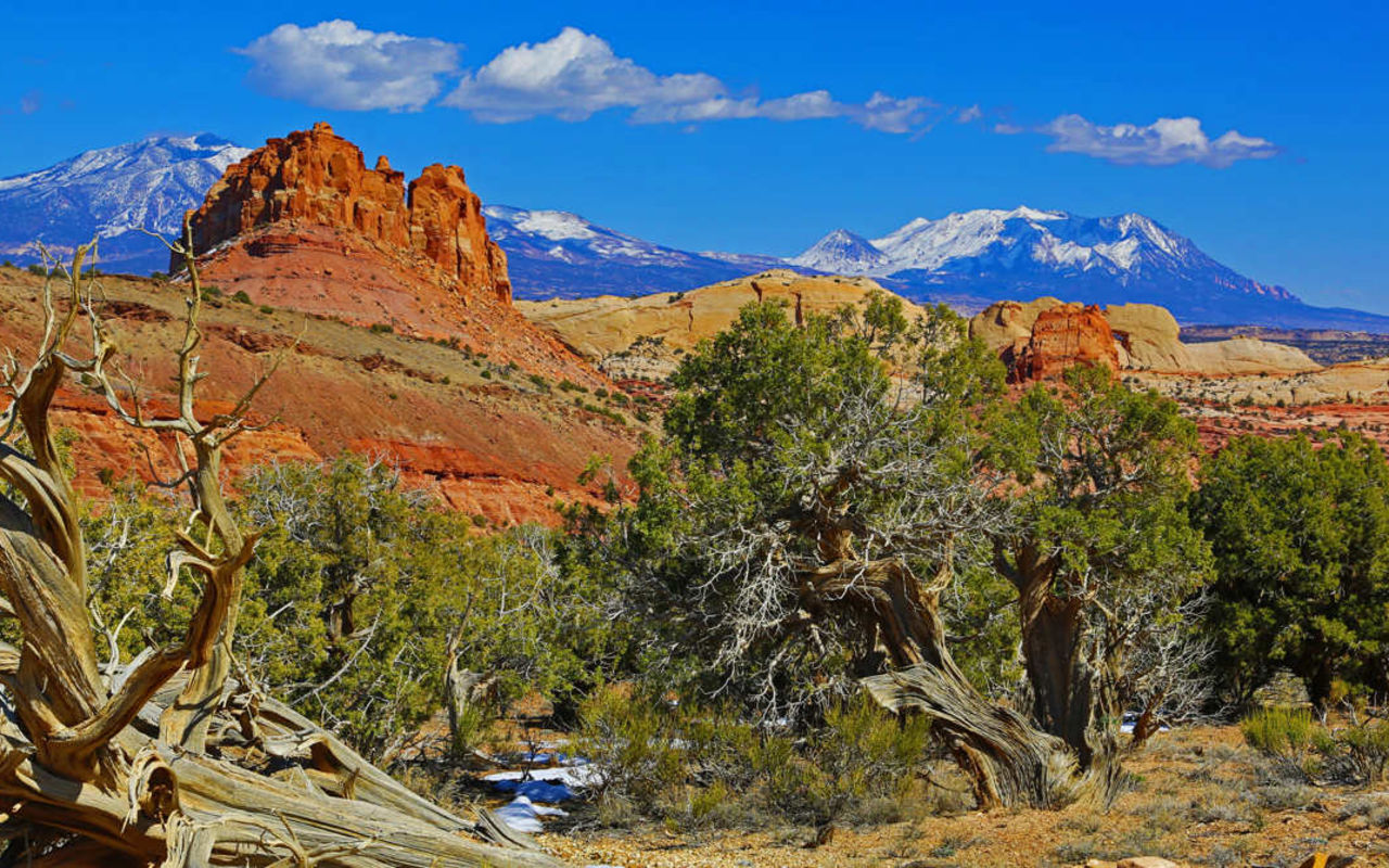
You will notice several distinctive plant zones in the Henry Mountain area. The distribution of plant life reflects the changes in topography, soil, temperature, and moisture relationships. The lower zones support primarily salt desert shrubs, blackbrush, and galleta grass. The intermediate zone is predominantly juniper and pinyon trees, and the higher elevations have several varieties of timber, including Douglas fir, spruce, ponderosa pine, and aspen. The highest elevations on Mt. Pennell and Mt. Ellen have alpine grasslands.
Geology
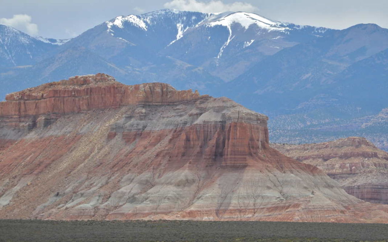
Millions of years ago, semi-molten diorite from within the earth's interior forced itself upward into the overlying layers of the earth's crust to form high domes called laccoliths. Today these domes form the five major peaks of the Henry Mountains. Erosion has now exposed the hardened diorite core of the mountains. The domed and arched sedimentary rocks are seen as flanks of the mountains range. Elevation in the area ranges from 3,700 feet at the north shore of Lake Powell to over 11,600 feet at Mt. Ellen.
Many of the unique geological formations of the Henry Mountain area are worth viewing during your visit. Located south of Hanksville off I-95, Little Egypt displays an odd collection of sphinx-shaped rocks which were formed by the erosion of Entrada sandstone. Located between Mt. Pennell and Mt. Ellen, The Horn is a good example of a lateral intrusion off the Mt. Pennell laccolith.
Horseshoe Basin is located between Bull Mountain and Mt. Ellen along the Sawmill Basin Road. It is one of the geological show places of the Henry Mountains, exhibiting the transition zone between the intrusive bodies and overlying sedimentary rocks.
On the extreme southern end of Mt. Hillers, the igneous intrusion process is dramatically displayed at the Pink Cliffs where several layers of pink sandstone were uplifted to a near vertical position.
The Blue Hills, south of Caineville, are of great importance to the science of geomorphology. The famous geologist G.K. Gilbert studied stream processes here in 1875-6. Studies by others continue today. These badlands can be viewed from Lost Springs and form the top of South Caineville Mesa.
The colorful Waterpocket Fold runs for 909 miles on the west side of the Henry Mountains. You can view the fold from several points along the Notom-Bullfrog Road or see it from McMillan Springs campground and Bull Creek Pass.
Majestic, isolated spires of the Entrada sandstone rise from the bottom of Cathedral Valley between Capitol Reef National Park and Caineville. In some areas, black volcanic basalt has folded its way between sandstone and layers or has filled fractures and cuts across rocks.
One of the richest uranium deposits in the region is found in Shitamaring Canyon. A new processing mill and town, Ticaboo, were constructed to develop the deposit.
Technical rock climbing at all levels of difficulty is found at The Horn, near Mt. Pennell.
Desert bighorn sheep are relatively rare. However, the remote areas of the Orange Cliffs, the Little Rockies and the canyons of the Dirty Devil River offer excellent opportunities for future relocation efforts to their historic ranges.
The famous Henry Mountains bison herd can frequently be observed along the South Summit Ridge of Mt. Ellen during the summer.
Recreation
Camping And Picnicking - BLM maintains three developed campgrounds and one picnic area in the Henry Mountain area. Also, there are numerous undeveloped camping areas throughout the region where you have little likelihood of meeting others. Take your refuge with you to an appropriate place of disposal.
Sightseeing - Driving any of the roads and highways will offer rewarding views of the area's geological features and wildlife. In particular, Bull Creek Pass, Stanton Pass and Pennellen Pass offer outstanding scenic vistas of the lower deserts. The canyons of the Dirty Devil River are best viewed from Burr Point and Angel's Point. Geological formations include the Pink Cliffs, Waterpocket Fold, The Horn, and Little Egypt.
Hiking - Short day hikes are possible in several locations. By far, the most popular place is Mt. Ellen. A 4-mile route from Bull Creek Pass to the summit of Mt. Ellen offers spectacular vistas of southern Utah. Another 4-mile trail leads from the Dandelion Flat picnic area near Lonesome Beaver Campground up to a ridge on Mt. Ellen. Short nature trails and day hikes are available at Starr Springs Campground and Hog Springs Picnic Area.
Overnight trips and extended backcountry trips are possible in a variety of locations throughout the area. Outstanding recreational opportunities are possible in the Little Rockies, the canyons of the Dirty Devil River, South Caineville Mesa, and Horseshoe Canyon. Further information on these and other areas can be obtained from the BLM office in Hanksville. For safety purposes, hikers should inform BLM personnel of their destination and length of visit.
Off-Road Vehicles - Most of the Henry Mountain area is open to ORVs. However, the steep mountainside, sheer canyon cliffs and generally rough terrain restrict ORV use to existing roads and trails in many locations. Please be careful where you ride so as not to cause unnecessary damage to vegetation or harassment of wildlife. Avoid riding on hillsides, especially those near roads where unsightly scars can develop.
THINGS TO DO
CAPITOL REEF NATIONAL PARK
REQUEST INFORMATION
TRAVEL BUREAU INFORMATION
CAPITOL REEF COUNTRY TRAVEL COUNCIL
12 UT-24
Torrey, UT
800-858-7951
Capitol Reef Weather
Average Temperature
Average Precipitation
Average Snowfall
Articles
View AllHappy Trails in Piute County
What do Delano Peak, the Paiute ATV trail and Butch Cassidy all have in common? Utah’s Piute County,...
8 Secrets to Sustainable Travel in Park City
Want a big adventure to Park City without a big environmental footprint? Utah.com can help you explo...
Utah County Is Festive As Heck
Fireworks, parades and corn on the cob — oh my! Utah.com has the scoop on the best festivals and fai...
Natural Bridges National Monument: A Hidden Gem, Not a Second Fiddle
An under the radar destination that should be on your radar. Learn all about Natural Bridges, Utah a...
Plan a Guys Getaway in Vernal
Planning a guys trip? Why not hit the ATV trails in Vernal, Utah with your crew? With all kinds of w...
Treat Yourself to a (San Rafael) Swell Winter
The San Rafael Swell is one of Utah’s hidden gems, and it gets even more hidden in the winter. Utah....
Plan a Triathlon of Fun in Greater Zion
Looking for things to do in St. George this fall? In addition to the IRONMAN 70.3 World Championship...
Color Me (Insert Emotion Here): Where to See Cedar City’s Feel-Good Fall Foliage
Richly hued views await you in southern Utah this autumn. Peep the changing leaves on a scenic drive...
Play Outside and See a Play Outside in Cedar City
Take a visit to Cedar City, Utah, and see why its access to both world class theater and stunning ou...
Mapping Out Utah’s Tastiest Cuisine
Getting to know the Beehive State means experiencing its sites and unique flavors. Discover both whe...
Get Your Peach Thrills in Box Elder County
Utah’s Box Elder county is a peachy paradise — part mountain range, part desert, part orchard and al...
9 Highest Peaks Across Utah
Take a peek at the tallest peaks in Utah. From Kings Peak to the Deep Creeks, Utah.com gets to the t...
Paving the Way for Everyone: All-Access Trails in Utah
From a wheelchair accessible waterfall trail to a lakeside boardwalk laden with wildflowers, these U...
Local Legends in Utah
Ever been curious about urban legends in Utah? Utah.com fills you in all things folklore with our gu...

