The Narrows
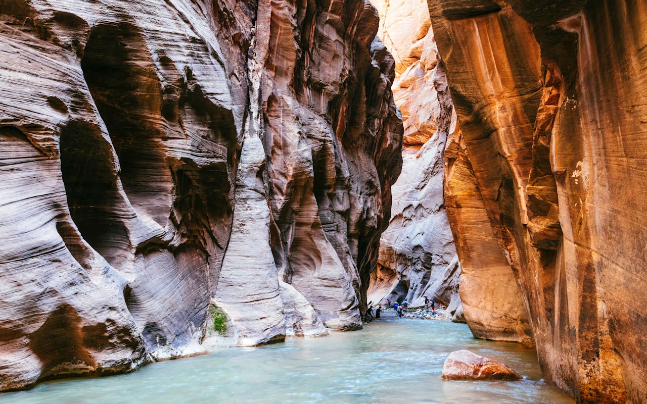
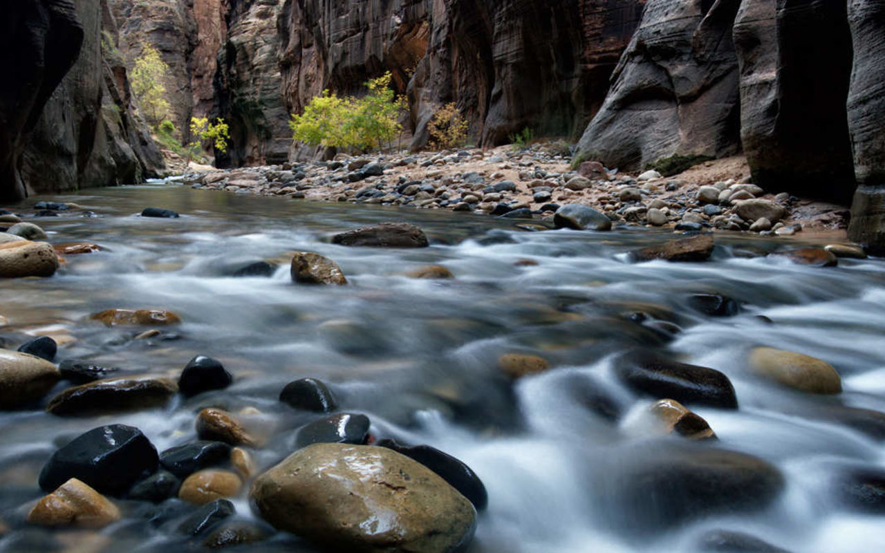
Slosh through the cool river that cut the canyon that's providing all the shade. You'll mostly be in up to your ankles but a few stretches get waist-deep. (Probably the wrong time to break out those leather pants.)
The Narrows is the most popular hike in Zion National Park, and one of the world's best slot canyon hikes. It is pure fun and can be tailored to suite any ability level. The trail is basically the Virgin River. The canyon is so narrow, the river covers the bottom in many spots, which means you have to wade or swim to proceed. Plan on being wet. In fact, the cool water makes this hike particularly pleasant during the hot months of summer.
This is a leave-no-trace zone. Other explorers, coyotes, lizards: they don’t want to know you’ve been there, so resist the urge to build an intricate cairn, declare in stone that John hearts Sara, or leave a trail of your fave protein bars. Plan to pack out all your waste. (Yeah, that kind too. You know what I’m talkin’ about).
Read more…
Promotional Links
Location
Zion Canyon
Difficulty
Easy to strenuous
Length
Variable, up to 16 miles
Weather
Hiking is not permitted when the river is high from runoff or flash flooding. Runoff mostly occurs in April and early May. Late summer thunderstorms occasionally produce flooding. Check at the visitor center for current conditions. Hiking is usually very pleasant during the summer and fall. Few people hike during winter and spring when the water is cold, but some go in wearing wet or dry suits.
Three Ways to Hike the Narrows
Bottom Up
The best way for first-time river hikers and those with only a short time in the park. Depending on water flow, this hike is easy to moderate in summer and ok for most kids 4 feet or taller. You can hike in as far you would like and turn back at any time. From the parking lot, it is usually only 2-3 hours into the section of Narrows known as Wall Street. Return hikers find it takes 2/3 the time to hike back as it did to hike in. Early Spring yields higher water due to snow melt. October and November visitors find fewer people in the river. The best light for photography is between 10 am and 3 pm, May-Sept. Average hikers travel 3-4 miles up the canyon and then 3-4 miles back. Bottom-Up hikers are only permitted to hike as far north as Big Springs. Accessible almost all year. The starting point is the Temple of Sinawava. You'll need to ride the shuttle into Zion Canyon, to Temple of Sinawava, and that takes about 45 minutes during the summer season.
Top Down - One Day
This 16-mile hike as a one-day event is the most strenuous option, but if you’re naturally athletic and agile, you should be just fine. Because it’ll be a long one, say 10 to 14 hours, try going between May and September so you have more daylight hours. And while you need to watch your step, remember it’s pretty out there. Stop along the way and look up, down and around.
A canyoneering permit is required for this one, so you’ll need to plan ahead and be flexible. Advanced lottery applications must be made at least two months in advance, where you’ll pick three possible dates. If you’d rather make it a two-day excursion, choose the wilderness permit and you can stay in a designated campsite. The permit system means a more secluded experience for you, and it helps preserve the area’s natural beauty and resources. Groups are limited to 12 people (leave Fido at home for this one).
For athletic people who are very agile hikers. Best done May through September when days are longer. Usually a 10-14 hour hike for most athletes. Very scenic if you take time to look up. Permit required. Max group size is 12 persons. Starting Point is Chamberlain's Ranch.
Top Down - Overnight
With the only disadvantage being the extra weight of overnight gear, this is the way to have the full Narrows experience. Spend one night under a blanket of stars in the canyon in one of 12 designated sites. Plan on hiking 6-8 hours each day with enough time to check out Deep and Kolob Creeks on day one, and Orderville Gulch on day two. Permit required. Max group size is 12 persons. Make sure to pack light (under 25 lbs.) The best time is May-September. The starting point is Chamberlain's Ranch, 1.5-hour drive from Zion Canyon.
Temple of Sinawava
(37.285, -112.947)
Most casual hikers start at the bottom, hike up the canyon as far as they feel comfortable, then return the way they came in. The hike begins at the Temple of Sinawava, Gateway to the Narrows, at the end of the shuttle route in Zion Canyon.
Into The River
(37.296803, -112.948238)
From Temple of Sinawava, the paved Riverside Walk leads up the canyon for about 1 mile. After that, the river becomes the trail - you just hike/wade up the river.
Orderville Gulch
(37.3078, -112.946)
Orderville Gulch is a prominent side canyon about 2.5 miles into the canyon. Most casual hikers don't make it this far, which is sad because the canyon here is very narrow and very beautiful. You can explore up Orderville a ways, if you want. An option for Canyoneers is to start the hike at the top of Orderville Gulch, hike down it and then down the lower narrows, and end the hike at Temple of Sinawava. (Orderville is a semi-technical slot canyon that requires short rappels, serious scrambling and much wading. A permit is required to hike it.)
Chamberlain Ranch
(37.385, -112.839)
For the complete adventure, hike the entire Narrows from top to bottom, from Chamberlain Ranch down to Temple of Sinawava. You'll need to shuttle to the trailhead, located along the North Fork Road, on private property on the east edge of Zion Park. A permit is required to high the entire Narrows.
REQUEST INFORMATION
TRAVEL BUREAU INFORMATION
KANE COUNTY OFFICE OF TOURISM
78 South 100 East
Kanab, UT 84741
435-644-5033
CEDAR CITY-BRIAN HEAD TOURISM BUREAU
581 N. Main
Cedar City, UT 84721
435-586-5124
Location
Get DirectionsZion Weather
Average Temperature
Average Precipitation
Average Snowfall
Articles
View AllHappy Trails in Piute County
What do Delano Peak, the Paiute ATV trail and Butch Cassidy all have in common? Utah’s Piute County,...
8 Secrets to Sustainable Travel in Park City
Want a big adventure to Park City without a big environmental footprint? Utah.com can help you explo...
Utah County Is Festive As Heck
Fireworks, parades and corn on the cob — oh my! Utah.com has the scoop on the best festivals and fai...
Natural Bridges National Monument: A Hidden Gem, Not a Second Fiddle
An under the radar destination that should be on your radar. Learn all about Natural Bridges, Utah a...
Plan a Guys Getaway in Vernal
Planning a guys trip? Why not hit the ATV trails in Vernal, Utah with your crew? With all kinds of w...
Treat Yourself to a (San Rafael) Swell Winter
The San Rafael Swell is one of Utah’s hidden gems, and it gets even more hidden in the winter. Utah....
Plan a Triathlon of Fun in Greater Zion
Looking for things to do in St. George this fall? In addition to the IRONMAN 70.3 World Championship...
Color Me (Insert Emotion Here): Where to See Cedar City’s Feel-Good Fall Foliage
Richly hued views await you in southern Utah this autumn. Peep the changing leaves on a scenic drive...
Play Outside and See a Play Outside in Cedar City
Take a visit to Cedar City, Utah, and see why its access to both world class theater and stunning ou...
Mapping Out Utah’s Tastiest Cuisine
Getting to know the Beehive State means experiencing its sites and unique flavors. Discover both whe...
Get Your Peach Thrills in Box Elder County
Utah’s Box Elder county is a peachy paradise — part mountain range, part desert, part orchard and al...
9 Highest Peaks Across Utah
Take a peek at the tallest peaks in Utah. From Kings Peak to the Deep Creeks, Utah.com gets to the t...
Paving the Way for Everyone: All-Access Trails in Utah
From a wheelchair accessible waterfall trail to a lakeside boardwalk laden with wildflowers, these U...
Local Legends in Utah
Ever been curious about urban legends in Utah? Utah.com fills you in all things folklore with our gu...


