Checkerboard Mesa
Highway 9 cuts right through the heart of Zion National Park. The road from the Park's south entrance to the east Entrance is 12 miles. After you enter the Park from the south entrance, you travel past the visitor center and the Zion Human History Museum. The road then follows the Virgin River until you reach the Zion Canyon Road (which is not accessible by car between April and October- shuttle required). From this point the highway winds up a series of switchbacks as you climb over 1,000 feet to the top of the canyon. Several pull outs are available for stopping and taking photos. As you reach the top of the canyon, you enter the Zion-Mount Carmel Tunnel.
The Tunnel was completed in 1930. The tunnel is just over a mile long. It cuts through the sandstone mountain ending at a parking lot that leads to two popular trailheads. The Overlook trail is a short hike (1 mile round trip) that takes you to the cliffs edge where you can see the winding road you just traveled on. This is a spectacular view of the mountains that surround Zion Canyon. The other trailhead is to Pine Creek. This is a technical slot canyon requiring advance canyoneering skills, gear and a permit.
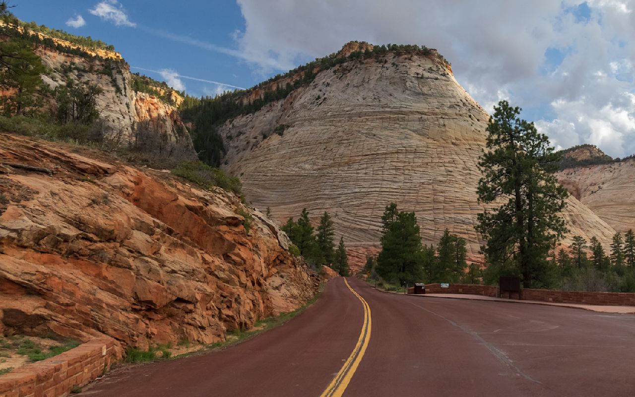
Once through the tunnel, the highway winds its way through Checkerboard Mesa. The unusual crack pattern in the sandstone hills resemble a grid much like you would see on a checkerboard. There are several pull outs along the highway and trailheads into some of the Zion backcountry.
Checkerboard Mesa | Photo Gallery

Checkerboard Mesa is an iconic and unique rock formation in Zion National Park.
Location
Get DirectionsZion Weather
Average Temperature
Average Precipitation
Average Snowfall
Articles
View All4 Reasons to Dump Disneyland for Zion National Park
Zion National Park is a playground sculpted by mother nature herself — and her attractions are kille...
Zion is for Adventurers
Follow this itinerary for the most amazing adventure in Zion National Park. Discover hiking, biking ...
Zion's 5 Best Short and Easy Hikes
Zion National Park has some of the best hiking in the world. Find the best short and easy hikes in Z...
Top 10 Things to Do at Zion National Park
Check out this list of the top 10 things to do and see in Zion National Park. Follow this guide to f...
Zion National Park Itinerary for All Ages
Need a plan for traveling to Zion National Park? Check out this three-day Zion itinerary that's suit...
HOW TO KEEP ZION NATIONAL PARK ALL TO YOURSELF & YOUR ENTIRE GROUP
Want to get the most out of Zion National Park? Try visiting in the off season between fall & spring...
Naturalist Kid Scavenger Hunt Zion National Park
Use this scavenger hunt for kids on your next trip to Zion National Park to identify plants and anim...
Rock Climbing in Zion with Mary Harlan
Mary Harlan and climbing partner Helen Sinclaire set out to achieve a new climbing record in Zion Na...
Zion, Escalante AND Bryce? Thrice as Nice.
Explore three of Utah's most famous national parks with a guided itinerary from Wildland Trekking.
Zion: Where Your Kids Will Take Theirs
The Zion Mountain Ranch is one of the best places to stay near Zion National Park. Check out the cab...
