Bryce Canyon Amphitheater
The Bryce Amphitheater area is the most visited section of Bryce Canyon National Park. And it is popular for good reason, since it contains many of the most famous structures in the park. It is also one of the most convenient areas to visit. It is located just southwest of the park visitor center and North Campground. The Bryce Lodge and General Store sit near the canyon rim above this amphitheater. The Sunset Campground is within easy walking distance to the west.
Short spurs from Hwy 63 (the main park road) provide access to popular viewpoints. The park shuttle stops at each of these viewpoints.
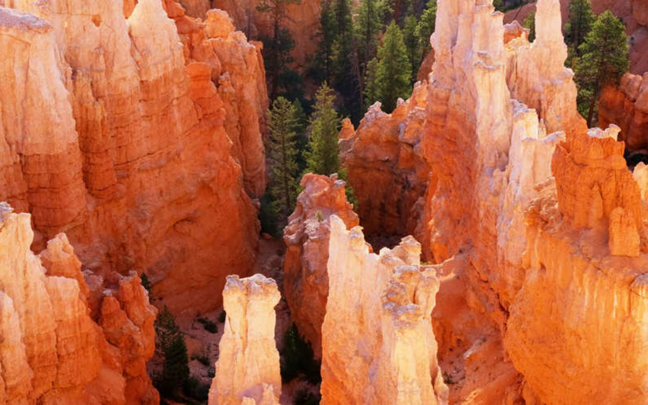
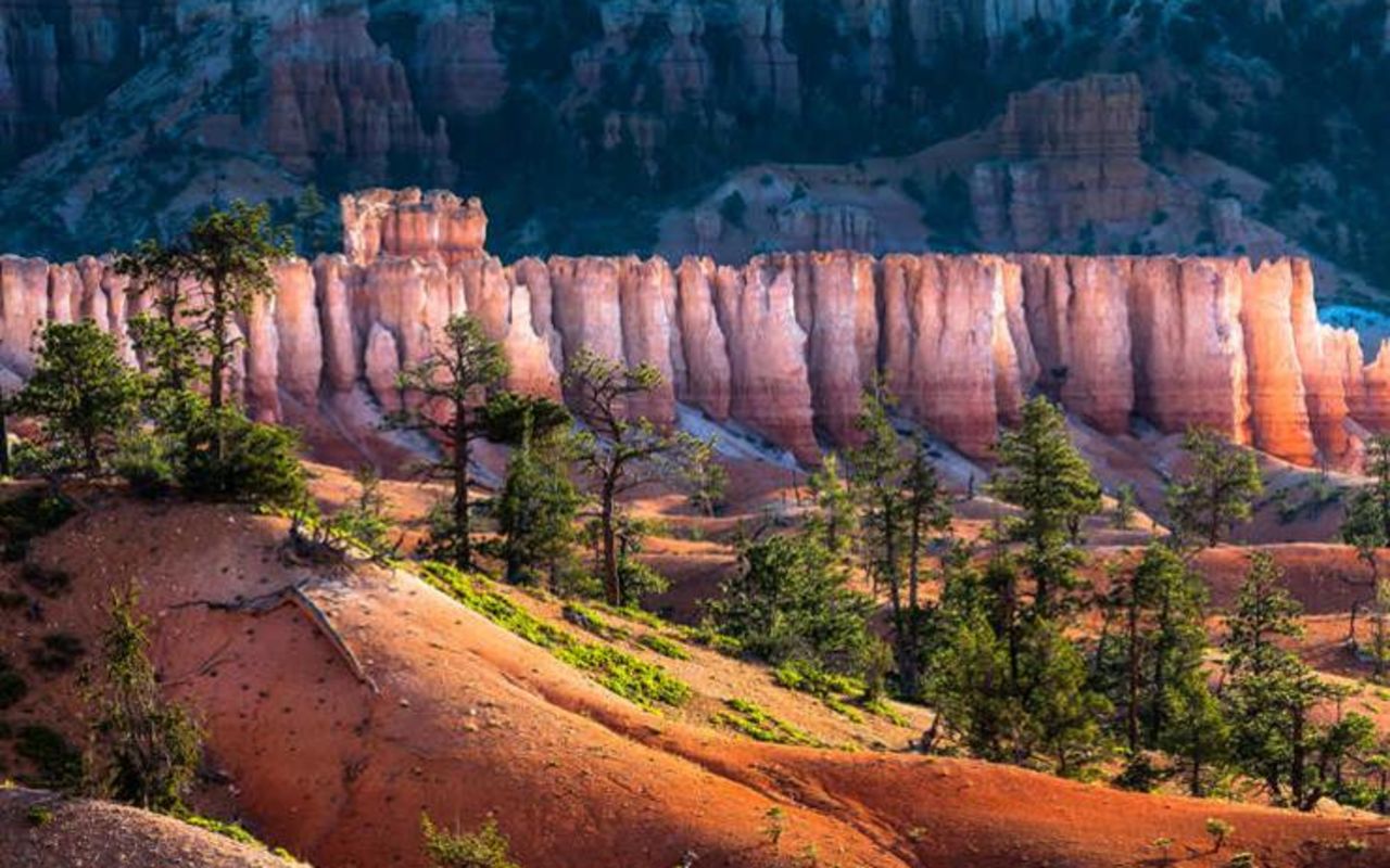
The Bryce Amphitheater is one of a series of "breaks" eroded into the eastern slope of the Paunsaugunt Plateau. The rock that caps the plateau has a pink hue and it varies considerably in terms of hardness. Over millions of years, softer spots have eroded away. Harder rock has remained and has been chiseled by wind and water into interesting shapes - the cliffs, hoodoos and castles that make Bryce famous.
View Points
That erosive action produced the Pink Cliffs, which run roughly north-south through the center of the national park. Hwy 63 stays on top of the plateau and runs parallel to the cliffs. Spur roads run out to viewpoints on the rim. From north to south, the major viewpoints in the Bryce Amphitheater are Sunrise Point, Sunset Point, Inspiration Point, and Bryce Point.
Each vista provides incredible views out over the Bryce Amphitheater. Photo opportunities are excellent in every area. Sunrise and sunset are key times when the quality of light is rich and the parks features explode into a kaleidoscope of colors. Most of the famous photos of Bryce Canyon were taken in the early morning or late evening hours.
Is Sunrise Point best at sunrise and Sunset Point more beautiful at sunset? Not necessarily. All of the points are spectacular at these times. At Bryce Canyon, you'll get good photos no matter which rock you stand on.
The Rim Trail
The Rim Trail follows the edge of the cliff above the Bryce Amphitheater, extending for about 5.5 miles. It connects points that overlook the amphitheater and then runs up to Fairyland Point on the north. The Bryce shuttle stops at all but Fairyland Point, so visitors can hike one-way between the points. Here are distances along the Rim Trail:
2.8 miles from Fairyland to Sunrise Point
0.5 miles from Sunrise Point to Sunset Point
0.7 miles from Sunset Point to Inspiration Point
1.5 miles from Inspiration Point to Bryce Point
The Rim Trail is mostly flat between Sunset and Sunrise points; it is suitable for wheelchairs. There are steep sections between the other points and so they are considered moderately difficult hiking.
Hiking one way along the length of the trail takes most people 2-3 hours. Total elevation ascent/descent is 1,754 feet.
Several trails drop down into the Bryce Amphitheater, so you can get right up close to the hoodoos and other structures.
The Queens Garden Trail
The Queens Garden is the easiest trail that descends below the Bryce Rim. The trailhead is at Sunrise Point. You can hike down and then return the way you came in, hiking as far as you are comfortable. You can also connect with the Navajo Loop Trail for a longer hike. The Queens Garden Trail provides great views of strangely shaped rock formations that were named by people with vivid imaginations. These formations include the Queens Castle and Queen Victoria. The trail extends for 1.7 miles one way. Total elevation ascent/descent is only 320 feet. Most people take 1-2 hours to hike one way along the trail.
The Navajo Loop Trail
The Navajo Loop Trail also drops down into the amphitheater. It passes through "Wall Street," a narrow slot between sheer cliffs, with towering Douglas fir trees growing along the trail. It provides outstanding views of much-photographed Thor's Hammer - a tall, narrow pinnacle with a narrower neck, supporting a large hammerhead-like rock.
Looking west from the trail you have grand views into the "Silent City" where rock structures resemble towers and buildings and temples. To the east, you can see the "Temple of Osiris." (Osiris is the Egyptian god of the afterlife.)
The Navajo Loop Trail extends for 1.3 miles, starting and ending at Sunset Point, with an ascent/descent of 550 feet. Most people take 1-2 hours to hike this trail.
Combining the Navajo Loop with the Queens Garden Trail, you can hike for 2.9 miles, looping from Sunrise to Sunset points. The combined trail has an ascent/descent of 580 feet. We recommend starting at Sunset Point because the slope up to Sunrise Point is more gradual and therefore easier. Most people take 2-3 hours to do the combined trails.
Amphitheater | Photo Gallery


Bryce Canyon National Park