Manti La Sal National Forest
The Manti-La Sal National Forest consists of three mountain blocks located in central and southeastern Utah.
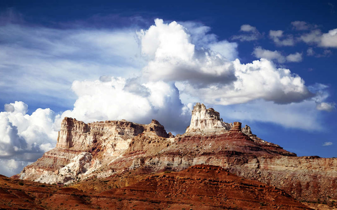
The forest's La Sal and Abajo mountain ranges provide excellent opportunities for hiking and mountain climbing and serve as scenic backdrops to state and national parks in the desert lands of southeastern Utah.
The Wasatch Plateau offers excellent camping, fishing, hunting and exciting ATV and off-road trails including the famous Skyline Drive and Arapeen Off-Highway Vehicle Trail System. Read more...
The Abajo Mountains, rising 11,360 feet above sea level, and their associated red rock plateaus just west of the town of Monticello, Utah, are rich in history as well as scenic beauty. Places named "Deadman Point," "Babylon Pasture," or "Chippean Rocks" conjure vivid stories of the early West of the white man, but the imagination can go wild over pictographs, petroglyphs, cliff dwellings, arrowheads and pottery left by Ancestral Puebloans and others who came before.
Along the eastern Utah border near Moab, the La Sal Mountains rise 12,721 feet above sea level. This part of the Forest provides climatic relief to the desert of the Colorado River Plateau. Narrow forest roads lead travelers to the high mountain passes, and into narrow canyons like Dark Canyon where the crystalline rock structure of the peaks is exposed for all to see or into Mill Creek where Oowah Lake sits as a small jewel amid spruce trees.
The northern, Wasatch Plateau area of the national forest offers scenic drives through the Huntington and Eccles Canyons National Scenic Byways known as the Energy Loop. These forest byways wind over the Plateau from levels of 5,000 to 11,000 feet. The energy aspects of the forest include a power plant, coal mine, and gas exploration wells. There are several high elevation lakes and streams that feature excellent fishing and camping, and the Arapeen OHV Trail System is popular with ATV enthusiasts.
Broad rolling ridges of the forest plateau have vegetation varying from deep green conifers to delicate, light-stemmed aspen separated by wild meadows where flowers bloom from snow melt until fall. The splendor of mountain greenery creates a colorful contrast to the vertical cliffs and escarpments which abound in the forest. The scenic drive includes the "backbone" of the plateau, known as Skyline Drive, which is also a bird watcher's paradise with eagle and hawk circling overhead.
The Wasatch Plateau section of the Manti-La Sal Forest contains a variety of recreation trails for foot, horse, and/or mountain biking traffic that provide access to some quality fishing opportunities in addition to breathtaking scenery, and includes the discovery site of the famous "Huntington Mammoth."
Manti La Sal National Forest | Photo Gallery


Manti-La Sal National Forest
REQUEST INFO & BROCHURE
TRAVEL BUREAU INFORMATION
MOAB AREA TRAVEL COUNCIL
25 East Center Street
Moab, UT 84532
SANPETE COUNTY
191 N Main
Manti, UT 84642
Location
Get DirectionsManti Weather
Average Temperature
Average Precipitation
Average Snowfall
Articles
View AllHappy Trails in Piute County
What do Delano Peak, the Paiute ATV trail and Butch Cassidy all have in common? Utah’s Piute County,...
8 Secrets to Sustainable Travel in Park City
Want a big adventure to Park City without a big environmental footprint? Utah.com can help you explo...
Utah County Is Festive As Heck
Fireworks, parades and corn on the cob — oh my! Utah.com has the scoop on the best festivals and fai...
Natural Bridges National Monument: A Hidden Gem, Not a Second Fiddle
An under the radar destination that should be on your radar. Learn all about Natural Bridges, Utah a...
Plan a Guys Getaway in Vernal
Planning a guys trip? Why not hit the ATV trails in Vernal, Utah with your crew? With all kinds of w...
Treat Yourself to a (San Rafael) Swell Winter
The San Rafael Swell is one of Utah’s hidden gems, and it gets even more hidden in the winter. Utah....
Plan a Triathlon of Fun in Greater Zion
Looking for things to do in St. George this fall? In addition to the IRONMAN 70.3 World Championship...
Color Me (Insert Emotion Here): Where to See Cedar City’s Feel-Good Fall Foliage
Richly hued views await you in southern Utah this autumn. Peep the changing leaves on a scenic drive...
Play Outside and See a Play Outside in Cedar City
Take a visit to Cedar City, Utah, and see why its access to both world class theater and stunning ou...
Mapping Out Utah’s Tastiest Cuisine
Getting to know the Beehive State means experiencing its sites and unique flavors. Discover both whe...
Get Your Peach Thrills in Box Elder County
Utah’s Box Elder county is a peachy paradise — part mountain range, part desert, part orchard and al...
9 Highest Peaks Across Utah
Take a peek at the tallest peaks in Utah. From Kings Peak to the Deep Creeks, Utah.com gets to the t...
Paving the Way for Everyone: All-Access Trails in Utah
From a wheelchair accessible waterfall trail to a lakeside boardwalk laden with wildflowers, these U...
Local Legends in Utah
Ever been curious about urban legends in Utah? Utah.com fills you in all things folklore with our gu...